| Linear Measurement: |
Square Measurement: |
|||
| 1 link = 7.92 inches | 9 square feet = 1 square yard |
|||
| 25 links = 1 rod |
16 square rods = 1 square chain | |||
| 1 rod = 16.5 feet | 1 square chain = 4,356 square feet | |||
| 100 links = 1 chain |
10 square chains = 1 acre |
|||
| 4 rods = 1 chain |
160 square rods = 1 acre |
|||
| 1 chain = 66 feet | 4,840 square yards = 1 acre |
|||
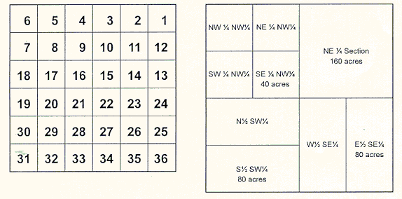
| 320 rods = 1 mile |
1 square mile = 1 section | |||
| 80 chains = 1 mile |
640 acres = 1 square mile |
|||
| 36 square miles = 1 township |
 Each township consisted of thirty-six sections of 640 acres each. Each section
included four quarter sections, eight half-quarter sections, and sixteen
quarter-quarter sections, each described by a series of directional indicators.
Each township consisted of thirty-six sections of 640 acres each. Each section
included four quarter sections, eight half-quarter sections, and sixteen
quarter-quarter sections, each described by a series of directional indicators.
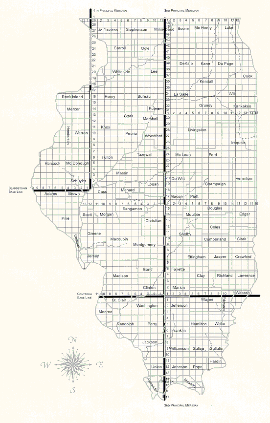
 Map and graphics courtesy of Barbara S. Heflin, Illinois State Archives,
Springfield, IL.
Map and graphics courtesy of Barbara S. Heflin, Illinois State Archives,
Springfield, IL.